Due to a decision made over a century ago, 1,434 NC land grants were never included in any of the online land grant databases: The Discover Online Catalog (DOC) operated by the State Archives of NC (SANC), its predecessor MARS, NCHRO’s free website http://nclandgrants.com which used the MARS data, and ancestry.com which independently cataloged the grants . Searchable records for all these grants have now been added to nclandgrants.com, making it the most complete database of NC land grants with 217,460 records.
Although their number might seem small, these grants represent almost 40% of all grants issued under the Lords Proprietors of North Carolina from 1663 to 1730, representing just under 1,000 individual land owners and a total of over 600,000 acres of land. Any online search prior to this would show the oldest grant was issued in 1680, when there are actually over 30 grants issued before then going back to 1663. Anyone researching land grants in this time period using only online sources should examine these records.
BACKGROUND
The reason for putting “missing” in quotes is these grants were actually recorded with the others in the land grant Patent Books, there is a drawer in the card catalog in the SANC Search Room with an index card for each, and Margaret Hofmann abstracted them in her land grant books. Where they are missing is from online databases, so unless you visited SANC in person or had Hofmann’s books you would not know these grants existed.
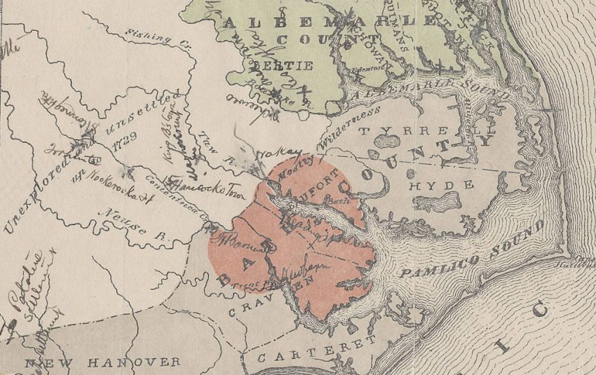
These grants were handled differently than the others because the county name was missing entirely, or was for a county that was not known. Prior to 1739, what we think of as counties were called precincts. There were 2 large jurisdictions that contained these precincts and those were called counties: Albemarle and Bath. In 1739 Albemarle and Bath Counties were dissolved, and all existing precincts were renamed as counties. For example, Edgecombe Precinct became Edgecombe County. The first 4 precincts were located in the Albemarle County using names we recognize today: Chowan, Perquimans, Pasquotank, and Currituck. However, for a short time period from 1679 to 1681 they were also known respectively as Shaftsbury, Berkeley, and Carteret, and land grants were issued under those names. Note this is not the same as current Carteret County – yes, there were two different Carterets in different locations at different times! It is not clear if Currituck had a different name at that time or was part of Carteret. An article is being written that covers all these issues – stay tuned!
These “missing” counties were added to the list of counties on nclandgrants.com, and grants issued with those names were cataloged as such. These new county names are followed by [ALB] to indicate they were part of Albemarle County, or [BTH] to indicate they were part of Bath County. There were 7 grants issued under “old” Carteret which were mistakenly classified under “new” Carteret, and those have now been reclassified.
NOTES
Many thanks to Paulette Smith for transcribing these records from the card catalog images
The new grants are in the same format as the other grants, so special searches are not needed and they are displayed like the other grants.
All land grants have a MARS ID assigned by SANC and this is how nclandgrant.com identifies them. The new records were never in MARS, so they all have “unofficial” MARS IDs starting with 12.14.901 . You will not find these IDs in the DOC catalog.
There are a very few records that aren’t actually land grants, such as records for lapsed grants. This is also the case for the land grants that were already on the website. To maintain consistency, these were included. At some point there will be a project to try and identify all of these non-grants and mark them accordingly.
Most grants are from the Proprietary Period. The actual breakdown is Proprietary 1311, Colonial 63, and 60 unknown because the date issued was missing or invalid.
There are 2 grants issued under Albemarle County which was the name of the larger jurisdiction that covered the Albemarle Sound region. It is not clear why they did not use the precinct name.
The following are the grants that were mistakenly classified under “new” Carteret county, now reclassified as Carteret [ALB].
| lSSUED | TITLE | LOCATION |
| 18 Nov 1681 | File No. 1, John Bolton | New Begun Creek |
| 18 Nov 1681 | File No. 2, Richard Cooke | At Craven river |
| 18 Nov 1681 | File No. 3, John Dye | At Newbegun Creek |
| 18 Nov 1681 | File No. 4, John Dye | At Craven river |
| 18 Nov 1681 | File No. 5, Isaac Guilford | At Craven river |
| 18 Nov 1681 | File No. 6, Stephen Scott | At Newbegun Creek |
| 27 Nov 1679 | File No. 7, John Harvey | .. falling into the river of Recoughtanke |
For more information on this specific topic, see the just released article:
McCorkle, David. “North Carolina Land Grants – No County Given.” NCGS Journal Volume 47 Number 4 (2021)
For information about NC land grants see:
McCorkle, David. “North Carolina Land Grant Records.” NCGS Journal Volume 47 Number 3 (2021):201-211
Margaret M. Hofmann, Province of North Carolina, 1663-1729 : abstracts of land patents, (Weldon: Roanoke News Co., 1979).
Margaret M. Hofmann, Colony of North Carolina : abstracts of land patents, 2 volumes, (Weldon: Roanoke News Co., 1982).
