NC Historical Records Online has started a project to create a public inventory of all existing maps showing NC land grants, and we need your help to find them all. Our hope is to have as many as possible on our website http://nclandgrants.com, or at least let researchers know where to find these maps.
BACKGROUND
There were around 200,000 land grants issued by the government to individuals in North Carolina from 1663 to 1960, but no maps were created showing the location and boundaries of these properties. Knowing the location of your ancestor’s land can reap huge benefits to your genealogical research, such as knowing the neighbors (the “FAN” club), determining where they went to church, where they did business, and what type of life they lead.
The property boundaries for each grant were described using a system called “metes and bounds”, and these descriptions can be found on http://nclandgrants.com . However, the description for a single grant is often not enough to locate the area today, especially when it is based on “landmarks” like an old oak tree by the creek or a “pile of rocks”. To locate the grant, you often need to find all the grants in an area and map them as a group – it’s kind of like a jigsaw puzzle, and can be quite time consuming.
THE PROJECT
In recent times, amateur genealogists and historians have created land grant maps for areas they were researching. Some of these are well known, but there is no one central list of all these maps. They could be online, on paper in a library, in books, on a personal computer, or even sitting in someone’s desk drawer.
Even though it appears that most of North Carolina has not been mapped, knowing which maps exist will be a big help to researchers. Hopefully this will encourage researchers to create their own maps for their region of interest without duplicating work. The ultimate goal would be an online map of North Carolina with all grant maps superimposed over it, linked to individual grants on nclandgrants.com
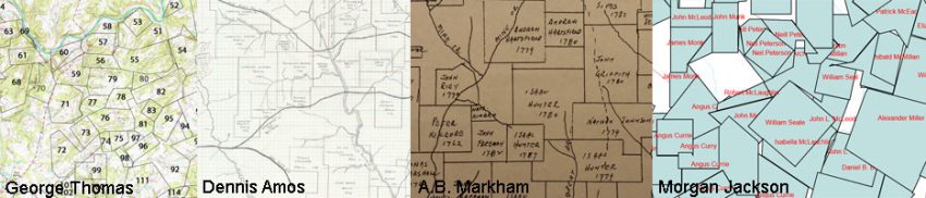
We are also interested in other maps showing landholders, such as the following:
https://www.loc.gov/resource/g3903c.la000586/?r=0.374,0.48,0.157,0.061,0
Click below for the form or other ways you can contact us about these maps: