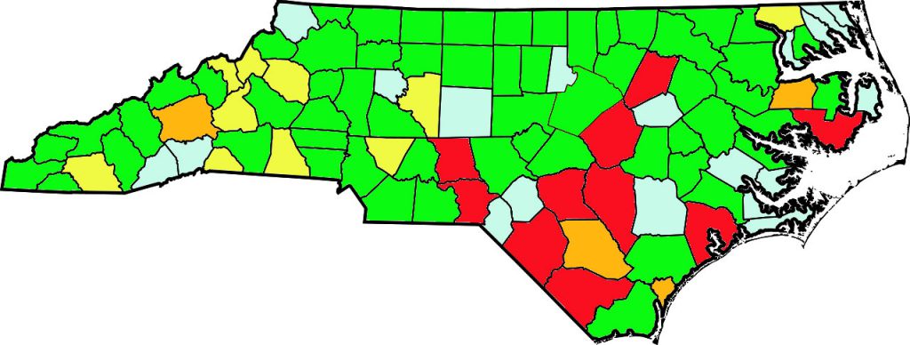
Green – shucks for that county are online
Light blue – shucks for that county are being processed and will be online soon
Yellow – shucks for that county have been fully funded for digitization but are not yet online
Orange – shucks for that county have been partially funded for digitization
Red – no shucks have been funded for that county

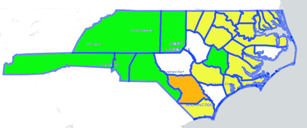
The land grant shucks are sorted by the county where the grant was originally located. Counties have split, merged, and boundaries have changed over the past several hundred years. This means showing the progress of this project on a modern map about is just a simple way of tracking and does not mean all the shucks for an area in green are online. It likewise does not mean that no shucks are not online for areas in white.
Although it would be time consuming to show maps for every different configuration of counties over the years, the following map indicates shucks that are online or funded for grants issued prior to 1770. In other words, if a grant was issued prior to 1770 in the green areas, then those shucks are online. Those that are funded but not online are shown in yellow.
